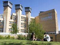
Environmental Hazards & Geographical Information Systems Master in Science

Speak without obligation to Coventry University

To contact you must accept the privacy policy

Image gallery

Comments about Environmental Hazards & Geographical Information Systems Master in Science - At the institution - Coventry - West Midlands

  • Academic title
    Environmental Hazards & Geographical Information Systems Master in Science
  • Course description
    Environmental Hazards range widely in nature from geophysical hazards such as volcanic eruptions, earthquakes and tsunami through flooding to biophysical hazards such as disease and drought. In addition technological hazards caused by human beings such as nuclear incidents, chemical accidents and other types of pollution and bioterrorism threaten the longer-term sustainability of our environment.

    This MSc course offers students the opportunity to develop skills and knowledge of Environmental Hazards coupled to the theory and practical experience required to apply GIS to map and analyse these hazards. The course structure enables you to extend your studies in disaster management, IT or a combination of both to suit your needs. You will have the opportunity to develop GIS skills in the use of ESRI ArcGIS, Clark Labs Idrisi, Intergraph GeoMedia and Erdas Imagine.

    Future prospects

    The US Department of Labor recently identified geospatial technology as one of the three most important evolving fields. The focus on Environmental Hazards provides you with opportunities to enter employment, gain promotion or change career direction into the environmental and/or insurance and risk management sectors in the UK and abroad. Graduates are well placed to work for local government, utilities, charities and international aid agencies, consultancy, GIS vendors and educational institutions, or undertake research leading to a PhD.

    Course content

    The MSc Environmental Hazards and GIS can be studied either full-time or part-time. You will complete 4 mandatory modules and enjoy a range of flexible study modes, including intensive workshops and distance learning. By completing one more module you are eligible for the award of a Postgraduate Certificate and successfully completing 10 modules makes you eligible for the award of a Postgraduate Diploma. An individual research project tops off your studies and leads to the full MSc award.

    Mandatory modules:

        * Concepts and Models of Environmental Hazards
        * Management of Environmental Disasters
        * Fundamentals of Geographical Information Systems
        * Geospatial Information Analysis
        * Individual Research Project (MSc only)

    Optional Modules include:

        * Disaster Theory
        * Risk assessment
        * Environmental Modelling
        * Digital Image Analysis
        * Programming Principles
        * Database Systems and Administration

    Additional support for international students

    Coventry University takes pride in the culture and richness that its international students bring to campus life. Currently over 2,000 international students from some 90 countries are pursuing programmes of study here, with a growing amount enrolling on postgraduate courses. A recent report ranked the University highly in terms of international student numbers, recognising our reputation as a leading international institution.

    To meet the needs of this rapidly growing community within the University's student population, our International Office is on hand to provide assistance on all relevant matters such as visas and immigration. It also serves as an information centre to help international visitors locate the many services and activities both on campus and further afield.

Other programs related to science & environment

This site uses cookies.
If you continue navigating, the use of cookies is deemed to be accepted.
See more  |