Course description
* Did you work hard for your degree but would benefit from a little more help to make the most of the promised opportunities?
* Are you seeking a new career or a move up the career ladder?
* Does your current job fulfill your expectations? Are you stimulated by your work?
* Are you highly motivated but feel you could achieve more if you had specialist skills?
* Are you willing to learn but would prefer not to sit exams?
If this is you then it may be the time to consider how studies in Geographical Information Systems (GIS) at Coventry University can brighten your prospects - in a way that focuses on your needs and with no exams!
If your are a GIS novice or an experienced practitioner the MSc by Research in GIS is designed for you to develop your knowledge and skills for the information society and knowledge economy. Geographical Information (GI) is widely used by public and private sector organisations to manage the physical infrastructure of towns and cities, optimise our use of natural resources, plan and deliver services to citizens and business, analyse environmental impacts and investigate the dynamics of crime and health. In fact, it is estimated that 90% of decisions are based on spatially referenced data.
The MSc by Research in GIS develops your capacity to make decisions through the analysis of digital GI and Earth observation images. You will achieve this by combining a knowledge of research design and methods with the skills to process data in one or more GIS and image processing system. And, if you are transferring into GIS or would benefit from bringing your knowledge up to date then we can offer introductory teaching in GIS and Earth observation by remote sensing. Skills and knowledge gained from the taught elements are then applied and refined through an extended research project.
Considerable use of e-learning is made throughout the program to provide additional flexibility and develop your competency for lifelong learning. You will also find that we encourage your creative use of the technologies and resources available in the new GIS Laboratory and refurbished Cartographic Unit and Map Library.
Future prospects
There are more than one and a half million unfilled IT positions in Europe and the shortfall is increasing. Demand for GI professionals is as strong as and perhaps stronger and more resilient than many other IT areas due to the pervasive adoption of GIS-based applications in public and private sectors. Demand is intensified by the relatively short half-life of IT skills (you can expect 25% of your skills to be obsolete in 3 years), emphasising the need for continuous professional development and opening up opportunities for newly-educated personnel. The MSc by Research in GIS is designed to equip you with modern knowledge and skills to develop your career as a GI analyst leading to senior analyst or manager. Opportunities are available across the full range of market sectors.
Course content
Your research project provides an opportunity to develop advanced skills and understanding of geospatial concepts, technologies and organisational issues. Through the project you learn how to design, implement and communicate the results of research investigations. You will work with one or more supervisors to investigate an issue of your choice. The issue may be driven by the challenges presented by modern GIS, the needs of a research group within the University or the requirements of an outside organisation or your employer. We strongly support the development of work-related projects.
(a) Investigations of geospatial concepts and development of GI technologies
Projects addressing the major scientific and technological challenges facing GI applications including integrating remote sensing and GIs, 3D visualisation and interaction, data quality, interoperability, image analysis, community participation and group-based learning through GI. These are some of our active research interests and provide you with an opportunity to learn from and contribute to cutting edge research projects.
(b) Applied research
Innovative GIS and image processing solutions to support research projects in environmental change, natural hazards, disaster management, health and healthcare, urban and rural planning or sustainable development. Work with our experts to develop and apply your GI skills.
(c) Work-based projects
A rigorous study of the problems and opportunities experienced by private and public sector organisations using GI. We have considerable experience in working with employers to identify, evaluate and resolve constraints in their use of the data and technologies. These projects may be particularly suited to GI professionals studying part-time or through split-site arrangements.
Additional support for international students
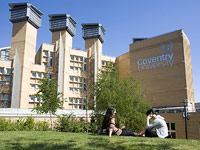
Coventry University takes pride in the culture and richness that its international students bring to campus life. Currently over 2,000 international students from some 90 countries are pursuing programmes of study here, with a growing amount enrolling on postgraduate courses. A recent report ranked the University highly in terms of international student numbers, recognising our reputation as a leading international institution.
To meet the needs of this rapidly growing community within the University's student population, our International Office is on hand to provide assistance on all relevant matters such as visas and immigration. It also serves as an information centre to help international visitors locate the many services and activities both on campus and further afield.